
211 Mining in Durbach
Anyone who knows Durbach as a wine village and resort, would not think that this place also has a rich mining history. We can see the first evidence of mining and smelting of iron ore as early as 1560. …
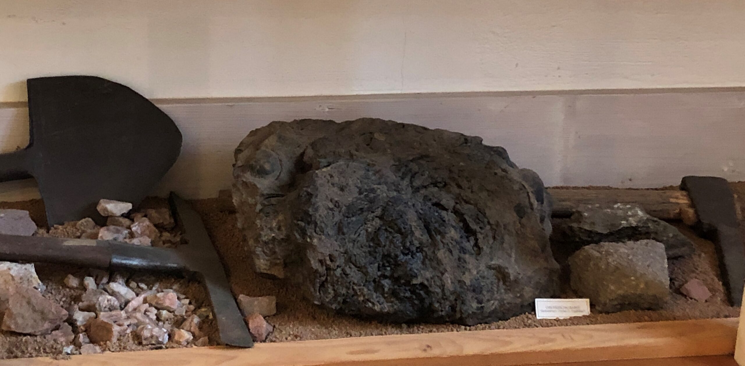
The brown iron ore as we see it here in the left display case comes from the St. Anton area. The old ore mines are beautifully marked on the historical map of the Hardtwald division from 1804 . It was Melchior Wiedergrün von Staufenberg who operated this iron ore mining for many years and, among other things, produced the beautiful stove plates that we can see one floor up later. The mining of iron ore and smelting process uses enormous amounts of wood, which, after a few years, lead to a dispute with other members of the woodland cooperative. Wood was also brought from the Moos mountain region. Due to the lack of wood, ore mining and smelting in Durbach ceased shortly after 1600, but was resumed a little later. In the mid 1600s, the iron ore from Durbach was also smelted in Oberkirch, after which the ore was driven to Bühlertal by ox or horse teams and mixed there with lower-grade ore. The valuable iron ore was dug up until 1791, when the deposits near St. Anton and around Staufenberg Castle were exhausted.
At times, the Durbach ore mine employed up to 50 people, and numerous miners and quarrymen migrated from Silesia but also from Italy and the Tyrol region. The smelting of iron ore in Durbach was presumably done in the Unterweiler district. The slope of today’s Plauelrain vineyard was the probable location of the ironworks but also the stamp mill, a machine that separated the gangue from the ore. Most of the ore veins are now buried or have also fallen victim to bulldozers in the course of vineyard reclamation in recent decades.
It has long been known that mining was carried out in the “Hilsbach” tine until probably the 17th century . According to tradition, several “springs” for the water supply in the Hilsbach are derived from old pits or tunnels. Thus, former pit openings are likely to be located on the current plots of land with the numbers 216, 245 and 253.
The pit in the vineyard area on parcel number 252 was opened as early as around 1970, according to local residents. At that time, the mine entrance was uncovered to access the water supply and a long pole was used to try to fathom the end. Even then, it was not possible to determine the depth of the pit or the end of the tunnel. In December 2005, local residents Glanzmann/Leible/Benz used an excavator to uncover the pit entrance because, on the one hand, the water for the service water supply had diminished considerably and, on the other hand, a new grading of the adjacent vineyard was planned.
The “well chamber” for the water supply is located on parcel number 252 just below the boundary with parcel number 253 and directly adjacent to the footpath parcel number 251. The pit entrance, and thus the “source” of the well pit, has now been established at a depth of around 2 metres and 16 metres up the slope to the northeast, with a distance of 2 metres from the footpath on parcel number 253. The pit mouth was closed with clay to dam up the water. The old water pipe was overgrown with bulb-like vine roots, so that hardly any water could flow through. The pipe used as an inlet for the well chamber was therefore replaced by a pipe with a diameter of ten centimetres.
The upper part of the mouth of the gallery is round and very smoothly beaten and has a width of almost two metres. The depth of the tunnel was found to be about 2.5 metres. How far the tunnel leads into the mountain could not be determined even with strong torches.